In the modern world, rapid growth in urbanisation and population has led to increased emergency incidences like crimes, accidents, riots, terror attacks, flooding, earthquakes, landslide, etc. In any of these situations, providing quick and better response to minimise the damage is one of the major responsibilities of the various agencies like law enforcement, fire and emergency medical services.
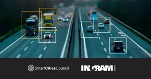
A state-of-the-art emergency response system—Rolta GeoCAD—has already been deployed in different parts of the country, including Maharashtra and Uttar Pradesh. This system is also well known as computer-aided dispatch or dial 100 system, which is deployed in the modern police control rooms. The CAD solution deployed at Lucknow and Mumbai police control rooms by Rolta is both desktop and web based for call taking, assessment of incidents, real-time tracking of response vehicles, deployment of resources and efficient management of incident towards favourable resolution. The solution provides situational awareness of the incident on GIS-enabled display for better visualisation and management.
How it works
This is an end-to-end call taking and dispatching solution from receiving and handling call for service (CFS) to recommend, dispatch and initiate action through the response vehicles/responding units (RU). The emergency events are generated based on CFS received through communication medium such as PSTN lines, cellular, police radio, SMS, email and SOS calls.
In addition, incidents are also created based on electronic information received from call triggered by an alarm in a premise. Based on inputs received, the location of the incident is established and concerned agencies are activated for initiating necessary incident management/threat mitigation measures.
The call taking functionality provides an efficient method of entering and validating information received from a caller for assistance, to a computer assisted dispatch center. The dispatching functionality feature provides operators with full dispatching capabilities allowing them to effectively monitor and track police vehicles and incidents on GIS map, and dispatch/control operations of the vehicles. All incidents and resource utilisation information is time-stamped and recorded into mirrored databases for post incident analysis and training.
Location identification
Here, the location of the caller or the incident is plotted and pops up on the GIS map as soon as the call is received in the CAD system. The control room operator is able to see the location of the incident on the GIS map. The incident location, if different from the caller location is seen using the intelligent search operation and marked on the map as incident location.
Vector maps of higher scale are made from the satellite imagery and enriched with different types of police specific layers, geographical boundaries and other attributes. If required, high resolution satellite data of the area is also viewed in the backdrop. This facilitates easy identification of location of incident and analysis of spatial distribution of the incidents across the city.
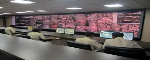
The solution provided to the Lucknow and Mumbai police is a new generation public safety solution, using latest technologies and is a leap forward in the public safety domain. These control rooms have become a trend setter in the public safety domain in the country.
Benefit
The modern police control rooms at Lucknow and Mumbai have now become the nerve centre of the city for maintenance of law and order. The geospatial system integrated with emergency response system or computer-aided dispatch systems have automated the entire operation of call taking, identification of the caller and location of the incident on a digitised map.
Now the response to an emergency is given by the nearest available resource or most appropriate resource. This has reduced the response time, thereby rendering timely assistance. The entire control room operations have been automated and redundancy provided for failover. Reports and analysis based on the MIS and GIS are used for preventive policing and allocation of constrained resource in the hot spots.