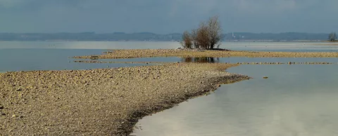
Texas is wet today, but two years ago nearly half the state was suffering from extreme drought. And with a population that’s expected to double over the next 50 years, it’s likely to run dry again.
Ensuring that everyone has enough and that the water is clean — nearly half the state’s water has quality issues today— is something that won’t happen by accident. It’s a job made more difficult when one watershed touches so many people, but is managed by different agencies.
At the Council, we have long advocated for tearing down silos that divide agencies and departments, and for using data to uncover solutions and track progress. The Texas Water Explorer, a new effort from The Nature Conservancy, a Council Advisor, does both, which is why it’s worth your attention.
As you’ll read below, its new data portal puts all of the relevant water supply, quality and policy information on one single map, even when that data comes from different sources. This approach undoubtedly helps bring leaders and the public together to help solve such a critical issue. And while this is for water, the idea behind this effort is worth exploring for any widespread issue you’re facing that involves many different players. — Kevin Ebi
Water planners and sustainability advocates have a new tool to help monitor the water supply in Texas — and take steps to ensure there’s enough for generations to come.
The Nature Conservancy created the Texas Water Explorer to collect and centralize access to the state’s water data, helping planners, policy makers, scientists and the public work better together to result in a sustainable supply. For several years, the state suffered from an extreme drought, a drought that was only alleviated by extreme flooding. While the drought is over, the state still faces a water shortage. More than 40% of the water sources are below levels that are thought to be sustainable.
The free website pulls together current data and trends on the state’s surface and groundwater — data from a wide range of agencies and organizations, including state, national and academic sources. Datasets came from the Texas Parks and Wildlife Department, Texas Commission on Environmental Quality, Texas Water Development Board, Texas Comptroller of Public Accounts, University of Texas, Texas A&M University, Michigan State University, International Boundary and Water Commission, U.S. Geological Survey, U.S. Fish and Wildlife Service and Texas Alliance of Groundwater Districts.
The tool brings together more than 20 indicators under six key categories: water quantity, water quality, ecosystem health, economic productivity, water governance and water conservation.
For instance, to help gauge the water supply, users can see the current reservoir storage and aquifer levels as well as trend in the weekly minimum flow. It also tracks how water is used, including demand for water irrigation, urban use and the efficiency of power generation. For water quality, the number of invasive species present and other metrics are also easily tracked.
More stories …
How cities are making every drop of water count
Is your city running out of water? The first place to look to find more
Water utilities: Dump your old business model (because you need a new one now)