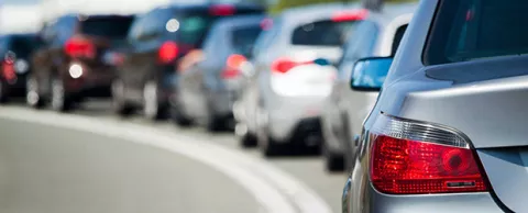
You can’t design a truly effective mobility solution if you don’t really understand where people are and when and where they need to go. But how do you get that data? Surveys are incomplete. Observation is error prone. Sensors don’t yet measure everything you need.
Several cities are finding there’s a great tool to track travelers and it uses something virtually every single one of them carries every day: their mobile phone. Cities like New York and Los Angeles are already learning about how people travel through aggregated usage data provided by Council Lead Partner AT&T. But that’s just the start.
The data AT&T Labs are collecting, for instance, could give Los Angeles comprehensive data about how commuters react to various types of congestion, allowing it to dynamically adjust traffic lights to minimize the impact. Privacy is always a concern, but data are anonymized. And some commuters see so much value in the project, they’re even opting-in to provide more information. — Kevin Ebi
Your best source for commuting data may be the device that most of us can’t live without: smartphones. Nearly everyone carries one and anonymous location data may be able to help cities build traffic models that are far more accurate than anything currently available.
For eight years now, AT&T has been using call logs to help New York, San Francisco and Los Angeles understand how people travel throughout their day. Every time you use your phone, that usage creates a record that includes the time and location. Combine just those two data points with the phone owner’s zip code and you get an idea of how, when and where people need to go.
There are already some useful insights, but as usage grows, this wealth of data could lead to robust models take more guesswork out of transportation planning.
First insights are in
Perhaps not surprisingly, people who live in New York City make very short trips. Half the people travel 2½ miles or less over the course of a typical day. San Francisco, however, is quite similar, with half of its residents traveling 3½ miles or less. In contrast, Los Angeles is much more spread out, which half of its residents traveling within a radius of up to 6 miles.
But it’s not just about knowing where people start and where they end up. You also get a good idea of how they get there, allowing you to more precisely pinpoint where the carbon footprint impacts are. In the case of Los Angeles, that’s not necessarily a straight line between home and work. Mountains northeast of the city force commuters to go around, creating significant carbon impacts well before those residents get downtown.
While the workday is an obvious first place to start, this call data can also help cities learn how people get to special events. AT&T studied how people get to and from parades, for example — providing more valuable insight for comprehensive transportation planning.
Building a transportation play book
For Los Angeles, AT&T Labs is working on a Connected Corridors Project using data to help the city forecast traffic. It starts with a giant cause-and-effect database. By learning how commuters react to accidents and other bottlenecks of varying severity in different locations, it can build a play book that allows transportation managers to adjust traffic signals and use other tools to more effectively ease the traffic jam.
A similar project in San Francisco, the SmartBay project, provided insight as to the best locations for park-and-ride lots and to run what-if scenarios to determine how best to manage traffic with temporary bridge closings and the opening of a new sports stadium.
Privacy matters
Assuring privacy is Job One. All data are anonymized before they are made available for traffic analysis.
However, some people have been willing to give up their anonymity because they see value in the research. In order to validate the initial findings, AT&T needed to find volunteers who would be willing to be tracked to see if the overall projections held true. Enough people opted-in that it was able to verify its findings against specific commutes. People do see the value.